|


| |
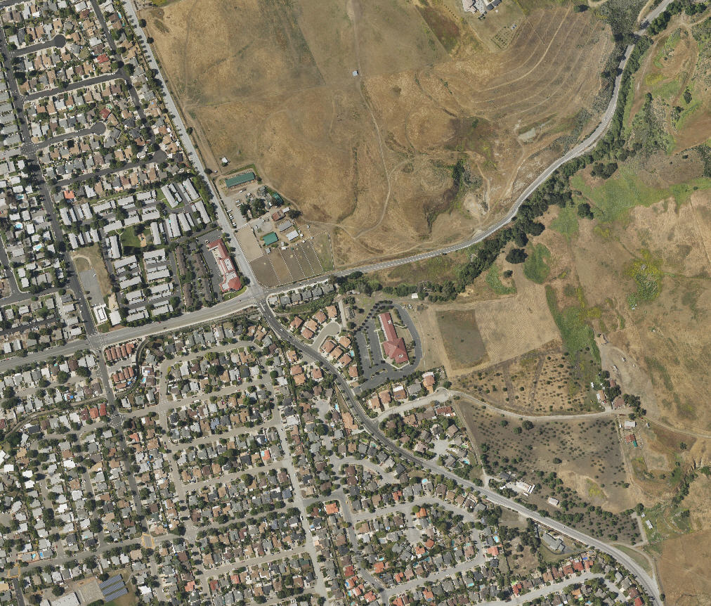
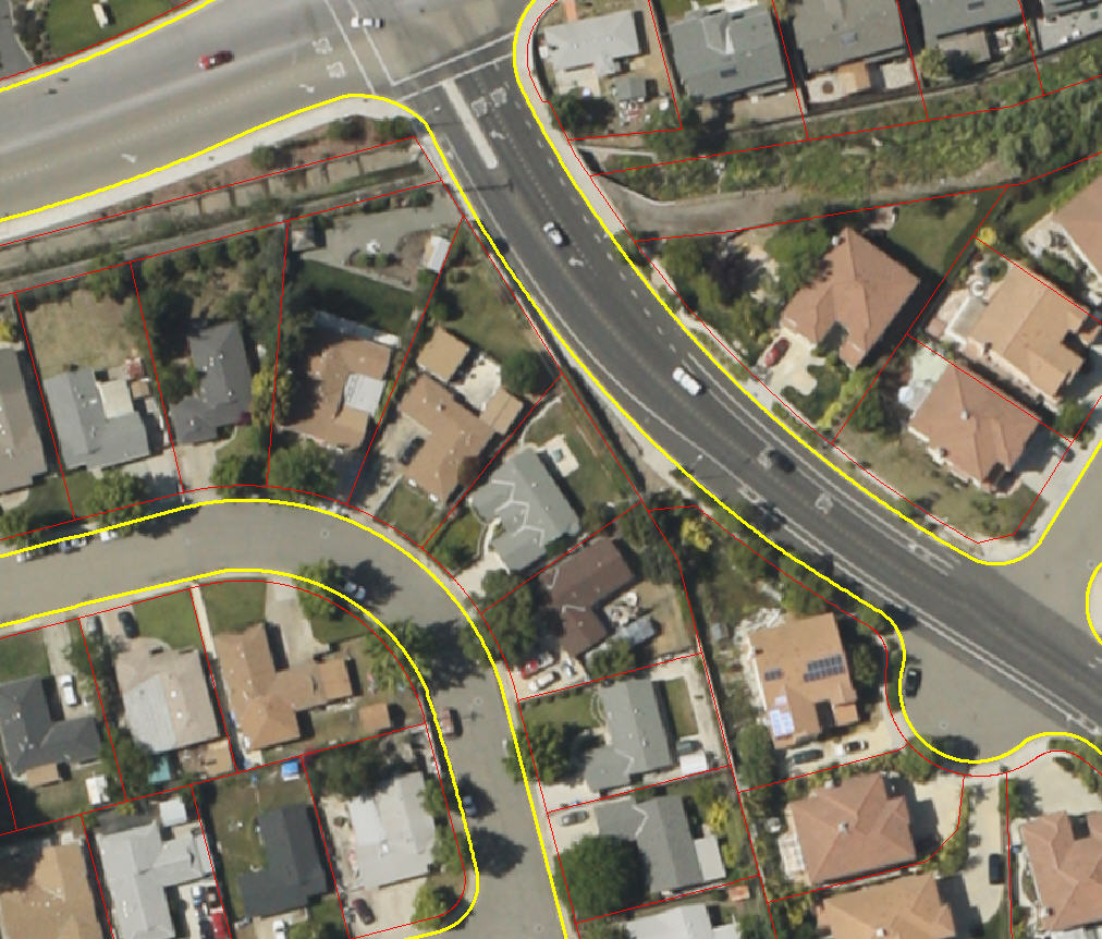
Geo-Rectified Urban Sample
Aerial Services is now deliveriing GeoTiff files at resolutions as fine as
4". The samples below are from Milpitas California. The total area is about 30
square miles, and the resolution is 8". If you would like access to the actual
file, please call us and we will give you access to our sample FTP distribution
site.
|
The following is a geo-rectified map layer that has been imported ArcGIS
and layered with a street edge and a parcel shape file The images were taken
on June 21. . Another overlay was produced showing building footprint
changes. |
Context View - Entire City of Milpitas, CA

Neighborhood View
Parcel and Street View
Geo-Rectified Wetland Sample
|
This is a geo-rectified map layer that has been imported into and layered
over a base map in ArcGIS. Another overlay, this one of streets, was provided by
the Riverside County map database. The map layer sample shown consists of three images. Color
contrast on the images was adjusted to show image boundaries. Our photo map
layers are useful for any number of projects, including, but not limited to:
construction, tidal boundary measurement, vegetation studies, transit projects,
etc.... |
Image data:
 | Location: Salton Sea south of the Coachella Valley in California |
| MapSetID : CVMap20090111AX |
| Image Date : 01/11/2009 |
| Image Sizes : 3744 x 5616 pixels |
| Nominal Pixel size : 6.2" |
| Ground coverage : 2270' x 3486' |
| Background : DOQQ imagery |
| Street Layer : Tiger Data |
| TIFF Image reference data: GCS_NORTH_AMERICA_1983 |
Click Here to to download the PDF version of the map
(Warning - this is a 10MB file!)
Contact Aerial Services for 90MB data sample (GeoTIFF)
|
